As a site, the urban coastline is coveted, contested, and contaminated. As a place of legend it is often exploited for its seedy undertones and larger-than-life characters. Increasingly, containerized shipping has grown to command the global economy, but with automation the coastline is a site of nostalgia for vanished jobs (wharfies, longshoremen, ropers, and haulers), fading accents, and overgrown infrastructure. It is a place where ecology, commerce, and historical memory intersect. The waterfront also serves as an important location for contemporary art projects and community engaged urban design.
In North America and Western Europe, the harbor was a bustling point that connected the city to the greater world. In Venice, Saint Petersburg, and Amsterdam the water was invited further into the city center to better facilitate the movement of goods. In the 17th century Golden Age, Amsterdam’s slim grachtenpanden (canal houses) allowed wealthy merchants to hoist spices and crockery from around the world directly into their living rooms. A polyglot, broad-minded culture took root. By the 19th century, as trade ballooned and water-intensive industry accelerated, harbors became polluted, semi-quarantined places where vice proliferated. But they were also points of arrival for immigrants and distribution centers for foreign goods and new ideas.
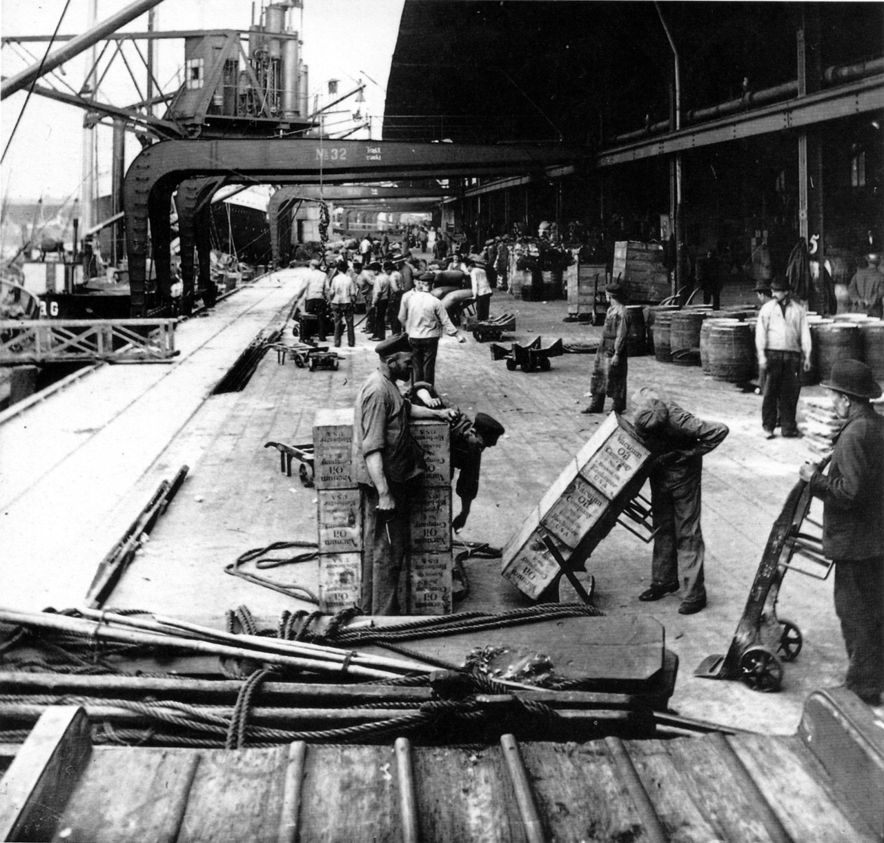
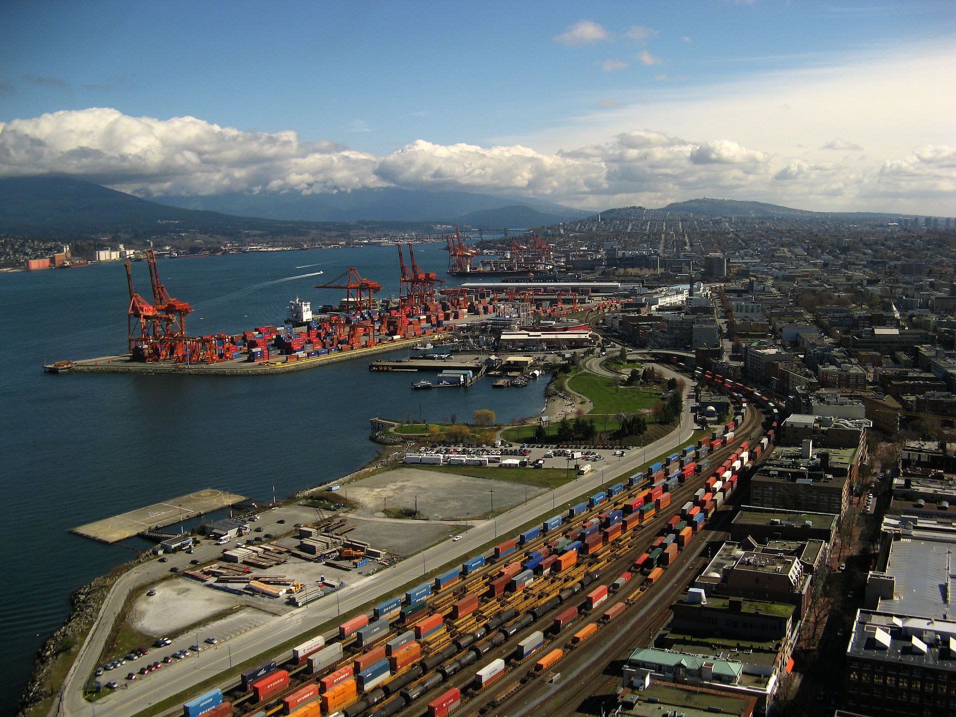
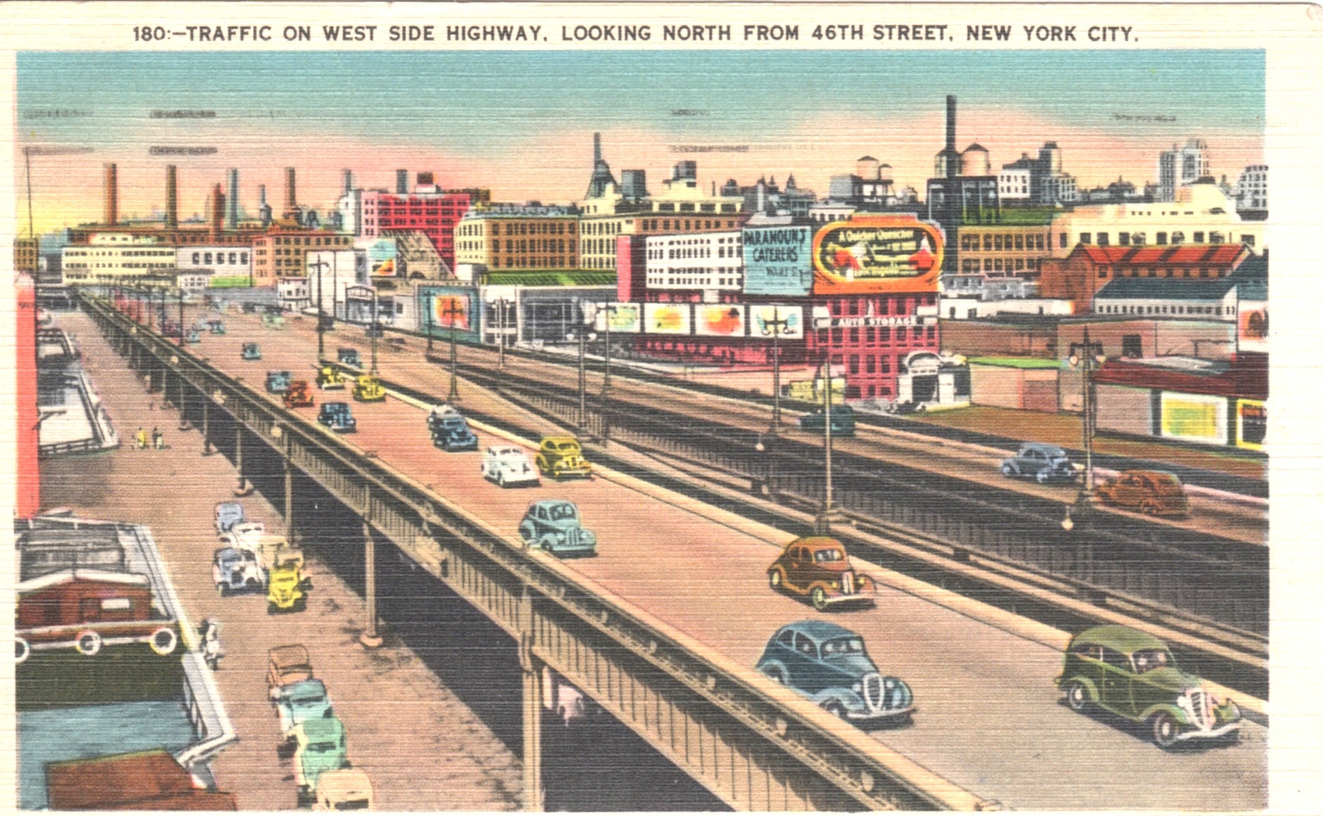
Inner city harbors have lay dormant since the rise of containerization and large cargo ports in the 1970s. The physical unloading of goods—a tight ballet of dockworkers, hand trucks, and rope—now happens via automated cranes in deepwater ports far from the city center. Goods, primarily from East Asia, now bypass North American cities to arrive at suburban ports like Oakland, Port Metro Vancouver, and Elizabeth (New Jersey). As central docks and connecting warehouse districts decayed, the land they sat on was already under threat from urban renewal and highway building efforts. When new roads reached cities they typically plowed through the lowest-income areas. Harbors, often abutted by large stretches of housing for low- and middle-income workers made a ready target. The legacy of unbridled highway building is that many North American cities remain sealed from the water that surrounds them.
The process of rediscovering the urban coastlines has been a complex one with numerous actors involved. Artists have led walks and devised projects in underused dock areas, marginalized groups have created culture and free spaces at the waterfront, and real estate and developers have sought to bring luxury housing and shopping to the character-rich warehouses and quays of major cities. New York and Amsterdam, cities with linked ship-faring pasts, provide particularly interesting examples of the cycle of deindustrialization, neglect, creative reuse, and subsequent redevelopment of portside areas. All of this occurs before the backdrop of a steadily rising sea and an industrial heritage that has left many of these areas deeply contaminated. Strategies for redeveloping coastal properties often use art (and artists) as an interim stage in the development process. How can these creative communities wriggle free from this relationship and create spaces that are not subject to the boom-and-bust cycles of the real estate market?
Artistic interventions in New York’s harbor and dead industrial areas played a large role in the art scene of the 1970s. The area between the Hudson River and the West Side Highway (part of a ring that girdles the city) was a place of transition made up of weatherbeaten warehouses, jetties, and splintered piers. One of Gordon Matta-Clark’s most famous architectural interventions took place over two months in 1975 at the derelict Pier 52 building in the city’s Meatpacking District. He perforated the building’s corrugated tin walls in an attempt to make an “indoor park.” The piece, Day’s End, capitalized on the enormity of the structure and the piercing, ecclesial beams of sunshine originating from the artist’s cuts in the facade. Matta-Clark, who established the collaborative restaurant-cum-art-project FOOD in SoHo and was an inspiration to many of the social practice artists of the late 1990s, planned to turn the warehouse into a publicly-accessible arts catalyst but it was shut down by the police and authorities, who subsequently demolished the building. Matta-Clark died of cancer not long after and never witnessed the area’s transformation.
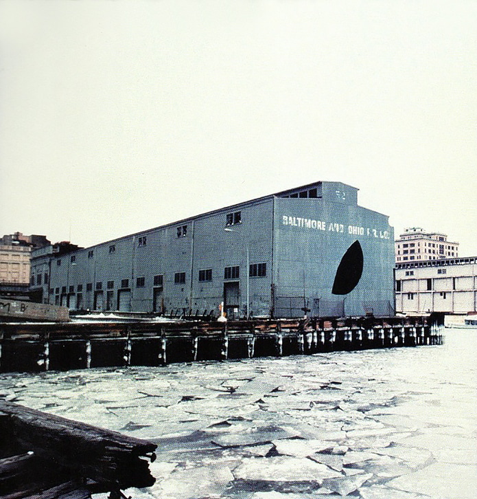
When Matta-Clark sawed into the Pier 52 building it had already been abandoned for years. Like many other areas along the West Side piers it had become a temporary home for queer teenage runaways. This subculture is immortalized in the intimate photos of Alvin Baltrop, who created some of the first images showing gay men having sex in public. Baltrop and Matta-Clark never officially met, but both were drawn to the abandoned waterfront at the same time. Baltrop captured the gay cruising spots and hookup culture of a carefree time that, after the AIDS epidemic, seems like a lost world. Matta-Clark came to the area because he sensed the spatial possibility of Manhattan’s industrial ghost towns. The two personify different sides of engagement in these liminal spaces. Matta-Clark, the son of artists, grew up in a SoHo loft and came to the waterfront to launch a project that he hoped would become a cultural catalyst. Baltrop, a gay black man from the Bronx, found refuge in the West Side warehouses as part of marginalized group seeking autonomy in the city’s unpoliced periphery. Some seek out the waterfront as a new arena for exploration and adventure and those pushed there by forces beyond their control.
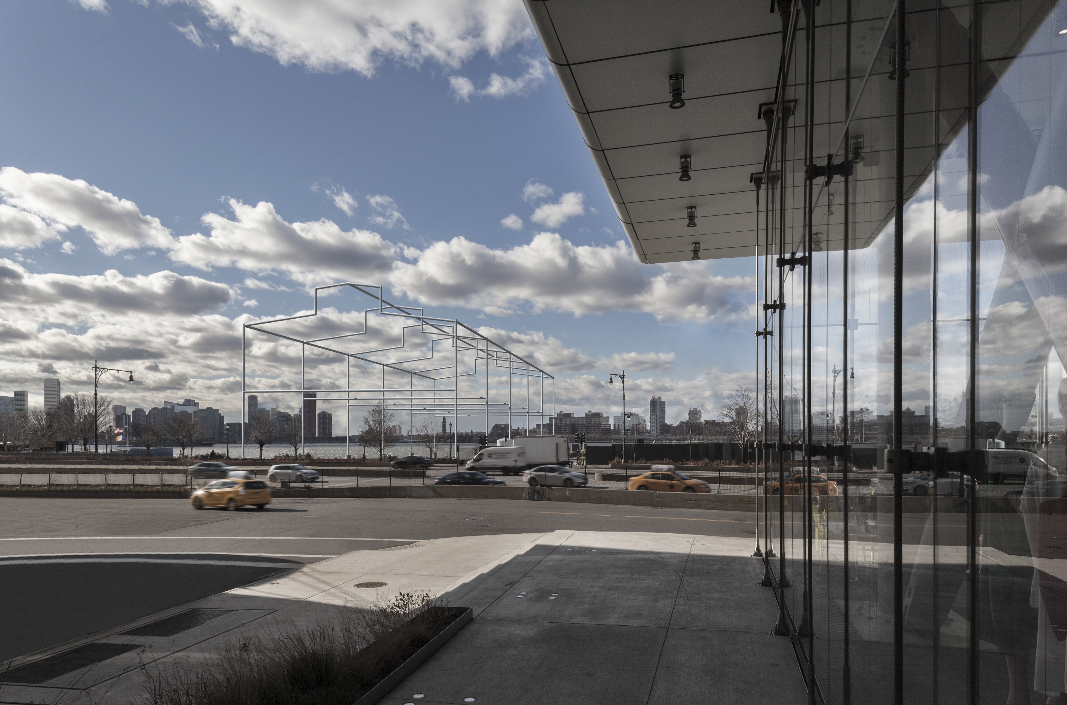
In the years since the demolition of Pier 52 subsequent waves of development— based on nightlife, galleries, and culture—have washed over the area. The transgender sex workers (who once lined the streets) have been forced out, as have queer homeless youth. Super-luxury condos, designed by a half dozen Pritzker Prize winners, and hotels have taken root. The Whitney Museum of Art’s new building is across the highway from Pier 52 site. Despite the radical changes in the neighborhood, the cross section of the area’s history is still visible: the architecture of the High Line, the famous linear park, highlights the fact that it once served as a railbed, bringing cows to their fate in the Meatpacking warehouses. The Whitney has commissioned a massive sculpture by David Hammons to commemorate the raised Pier 52 building, and the city has committed over $15 million to refurbishing the district’s charismatic cobblestone streets.
The relationship of many Downtown artists to the post-industrial waterfront of the late 1970s, should be seen within the context of this now-romanticized period: a city in fiscal freefall, plagued by crime, and out-migration was beguiling to free-thinkers because—not in spite—of these issues. The abandonment of industrial buildings in the city’s core created a situation that had not been seen before (or since): exceedingly cheap (or free, for squatters) square footage sitting on top of a still-functional transit infrastructure and in close proximity to many of the country’s blue chip cultural institutions. This economic situation, and a cultural shift away from suburban placidity, helped usher in a democratic, freewheeling art scene.
Some artists, notably David Wojnarowicz, Martin Wong, and Peter Hujar, where captivated by the abandonment they saw around them, and their works zoom in on the city’s faded grandeur as if it were a folly set in a manicured garden that spanned all of the United States. Other artists, like Agnes Denes and Vito Acconci, turned away from the romantic and took the situation as a jump off point to posit new, playful visions of urban life. Denes started creating large-scale environmental installations in the late 1960s. Unlike other Land Artists, she is best know not for work in a far-flung locale, but for one in the city. In 1982, she planted and tended a two-acre wheat field on a landfill generated by the construction of the World Trade Center. The iconic piece problematizes the urban-nature binary and puts forward a new way of seeing the city. The sharp juxtaposition of food cultivation from the air-conditioned labor of bankers in the World Trade Center highlighted the fact that New York was turning away from a city based on corporeal labor towards a place purely reliant on financial services and cultural production.
Revealing the nautical infrastructure at the waterfront often meant breaking through a more recent vintage of infrastructure: elevated urban highways. Belt roads allowed suburbanites quick access to the urban core, often by cutting in along the water, but by the 1980s many cities were rethinking this front-and-center placement of auto infrastructure. Boston embarked on the “big dig” to bury a crosstown interstate highway and several cities tore down or aborted roadway projects (Amsterdam lost its nerve on a highway project only after clearing most of its historic Jewish district). Fishers, walking groups, and nature enthusiasts broke through highway barriers to reach the water. Groups like the Shorewalkers, founded in New York in 1982, staged marathon walks along the banks of the Hudson River and advocated for right-of-way for access. This harkened back to an older tradition of hiking as a means of asserting public space, a popular means of protest with the leftist ramblers of Britain in the 1930s.
Other groups saw walking the city through an explicitly artistic lens, channeling artists like Hamish Fulton and the naturalists of the 19th century. Dillon de Give, a co-founder of the Walk Exchange, a cooperative walking group that has based walks on the migration paths of urban coyotes and the edges of flood zones, gravitates towards spaces that aren’t heavily defined. He notes that “naturally occurring pedestrian paths lead to and follow the water in many neighborhoods, in our dense urban environments the simple act of being able to see further can be spiritually nourishing.” The preservation of waterfronts, and their continued public access, is crucial for allowing city dwellers their “Sitting by the Dock of the Bay” moments of reflection and clarity. Removing physical impediments to access the waterfront is good for public health, as well as urban design.
Some artists saw the waterfront not just as a site for new works but as a potential new home. In the 1970s, facing an acute housing crises, Amsterdammers took up residence in houseboats along the city’s famous canals. The Eastern Docklands, abandoned by shipping companies because it could no longer accommodate large vessels, was taken over by squatters, hippies, and houseboat dwellers in search of alternative community. Today, houseboats are trendy and coveted, but at the time living the still-polluted waterways was not an attractive option. Artists and bohemians were some of the few to drop anchor on the canals. One of the most famous houseboat dwellers was Lawrence Weiner, who first traveled to Amsterdam in the early 1960s and has lived on a houseboat there since 1970. 1
- https://www.moma.org/documents/moma_press-release_387188.pdf
The decline of the Dutch capital’s oceangoing industries was far more gradual than New York but it nonetheless has left a hole in the national psyche. Dutch has countless expressions derived from sailing and shipping: the sea and city are inextricably linked. In Amsterdam, as in many other cities, the culture of maritime labor is still a large part of the lore, even if the professions of stevedore and longshoremen disappeared decades ago. 2
- https://www.nytimes.com/2018/04/23/business/grimsby-brexit.html
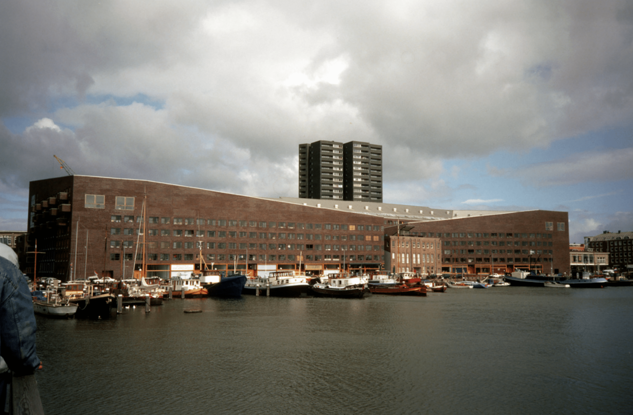
Architecture plays a key role in the commemoration of these trades. The NEMO Museum of science, designed in 1997 by Renzo Piano, takes the form of a ship clad in green tile. Set on the tunnel that connects the city’s northern and southern parts, the building hovers over the city and features a publicly-accessible rooftop, from which one can see a near panoramic view of the city’s historic core. In the foreground, you spot the nearby Shipping House, a goliath built in 1916 in the Amsterdamse School style to house the offices of the city’s six leading trading companies. The seven-story brick building is flanked by carved-stone goddesses representing the world’s oceans. Across town, on a dam originally created for oil tankers, the Dutch firm MVRDV built Silodam in 2003. The building’s maritime inspiration is clear but instead of looking back to a glorious past of carracks, it soberly acknowledges the future. The building—formed out of multicolored three-dimensional blocks—resembles nothing so much as a cargo ship setting out to sea.
One of the most visible holdovers from Amsterdam’s past as a sailor’s paradise is the city’s well-cultivated reputation as a vice capital. Tourists expecting a pirate’s island of bordellos and bongs might be disappointed to find instead a tidy city striated by canals and lined by bike paths. Still, the municipal government promotes a certain idea of refined seediness. The Roze Buurt, the district of legal prostitution, is increasingly home to artists and pop-up shops, as many of the sex worker windows have been shuttered due to concerns over human trafficking. The city has sought to maintain the right balance between upholding its libertine image (a draw for tourists, even those who do not partake in sex and drugs) and guarding public health. Artists find themselves in the crosshairs—often brought in to ‘clean’ neighborhoods as they transition from hardscrabble to desirable. In the Red Light District, artists where offered free ateliers in the windows once occupied by prostitutes—so long as they left the curtains open while working. This performance of art-making highlights the role of artists play, often unwittingly, in turning over harborfront areas.
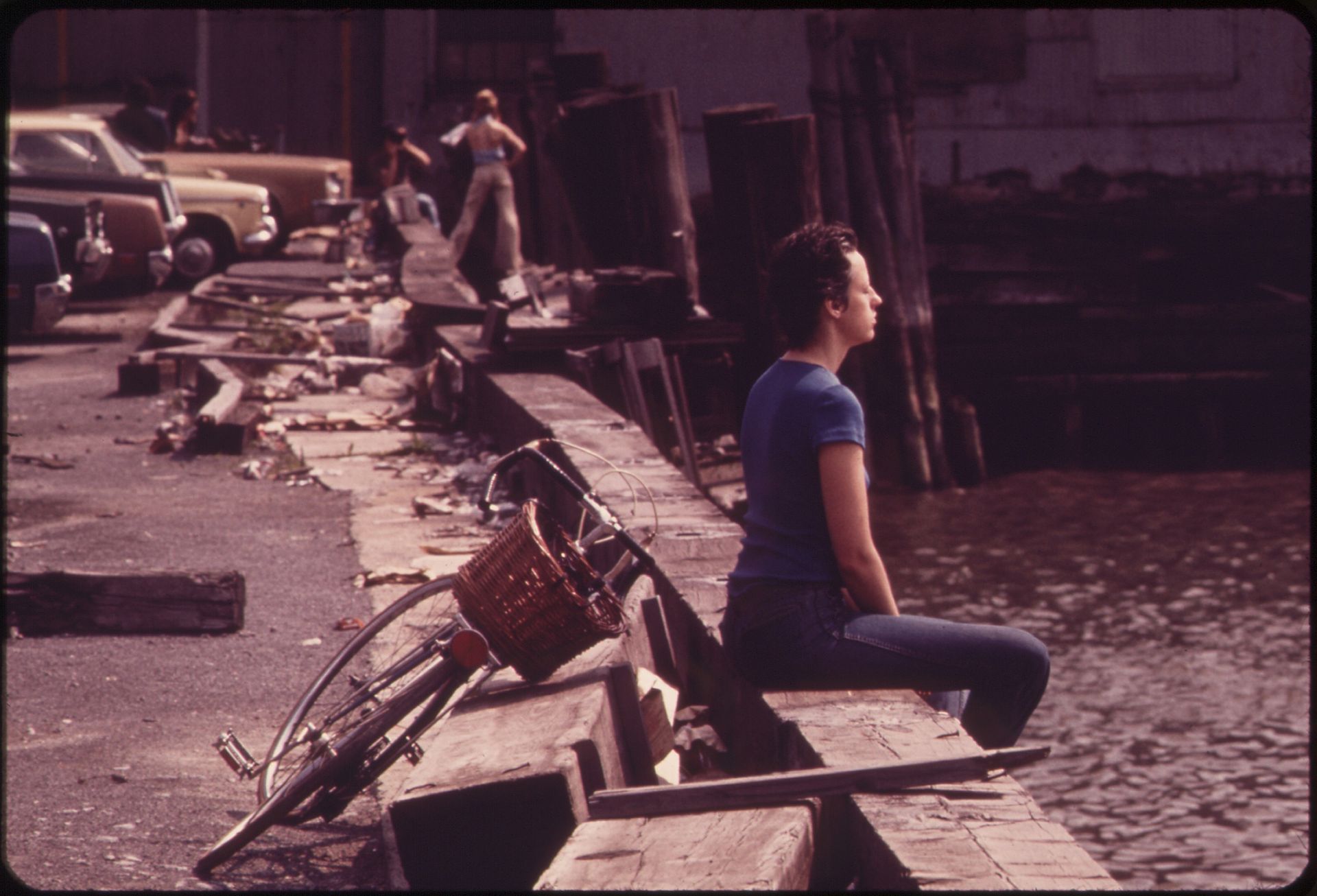
The creative reuse of the urban harbor that culminates in architectural projects is often presaged by performative works that take the formerly-industrial coastline as a terrain to be activated. In Brooklyn, before Williamsburg became a redhot real estate market and a byword for a certain kind of tattooed cool, it was home to an artist enclave. These creatives and cultural workers found cheap housing in lofts nestled at the confluence of Hasidic, Latino, and Italian communities and a fading industrial terrain. In the early 1990s, artists cut fences and hopped retaining walls to gain access to a weed-strewn waterfront lot that had been a railroad switching yard. From the mid-1990s to the early 2000s, this spot became a place of casual encounter, an ad hoc skatepark, and a public beach. It was a sliver of urban nature used for both reflection and recreation. Looking back, this vanished space had many of the qualities of Foucault’s heterotopia: it allowed for alternative social interactions and existed (temporarily) outside of the push and pull of capital. In Brooklyn and other cities, reclamations of the remains of warehouses and bulkheads became a bohemian right, and, once opened, these spaces welcomed nudists, graffiti writers, musicians, and artistic mischief-makers. However, this informal activation of space was almost always temporary.
The filled-in land that Agnes Denes seeded to create Wheatfield was developed as Battery Park City, Manhattan’s only master-planned residential neighborhood. While some of the artists who created works for the space in its transitional days have played a role in landscaping and programming Battery Park City, notably Mary Miss, the possibility inherent in their works has been dulled as postmodern glass towers have turned the area into a bland hamlet. On the Williamsburg waterfront, towers have also sprung up and artists have been pushed miles down the subway line. Much of this stems from the 2005 “up-zoning” of Greenpoint and Williamsburg, turning a neighborhood of industrial buildings and modest ‘triple-decker’ apartment houses (primarily home to working class Polish and Puerto Rican families) into a forest of hotels and luxury condominiums, with some reaching 30-40 stories in an effort to capture Manhattan views. The rezoning was deeply resented by many existing community members, and, in an effort to make the changes more palatable, the city committed to building a five block-long park along the waterfront at a point called Bushwick Inlet.
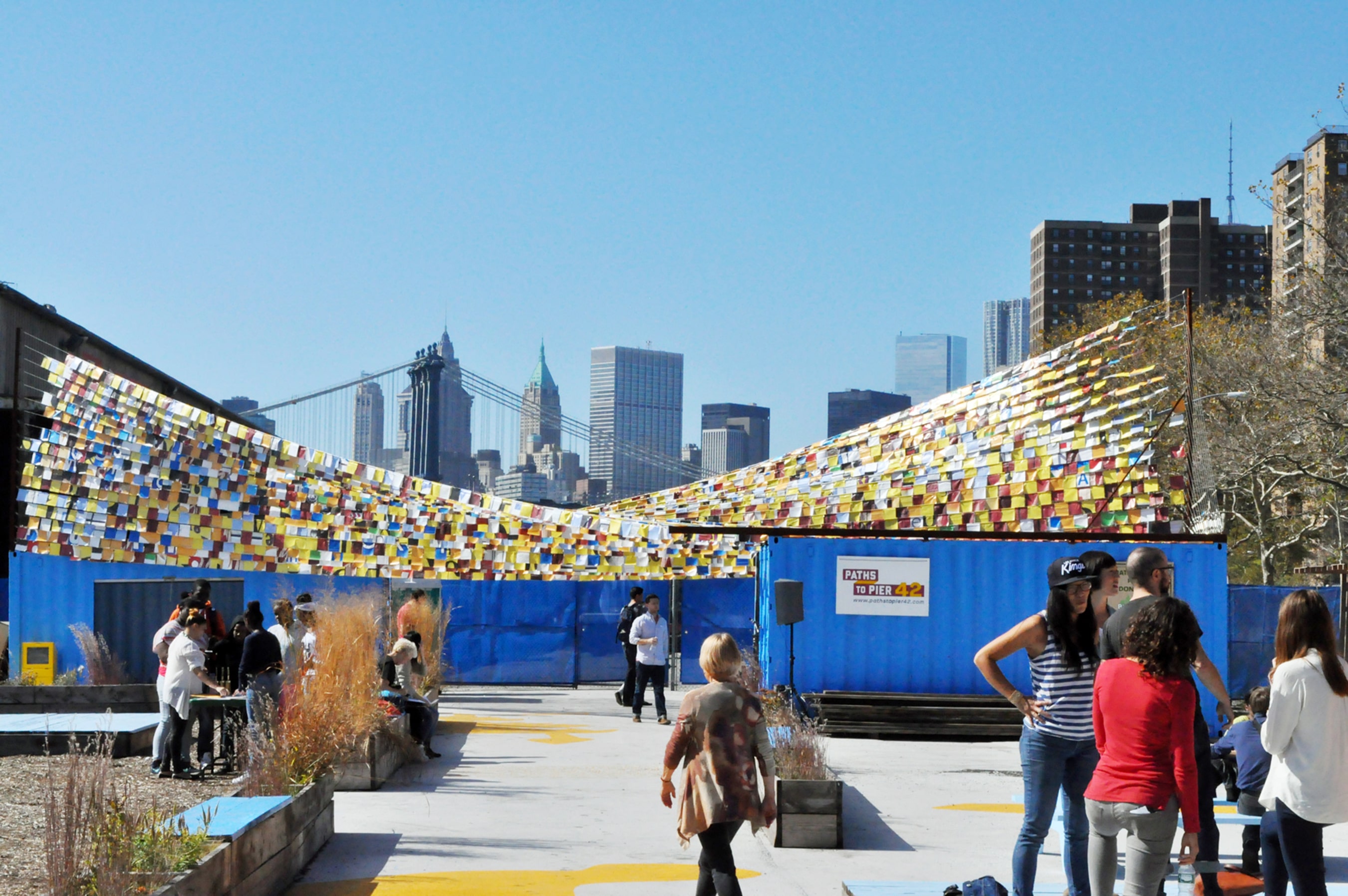
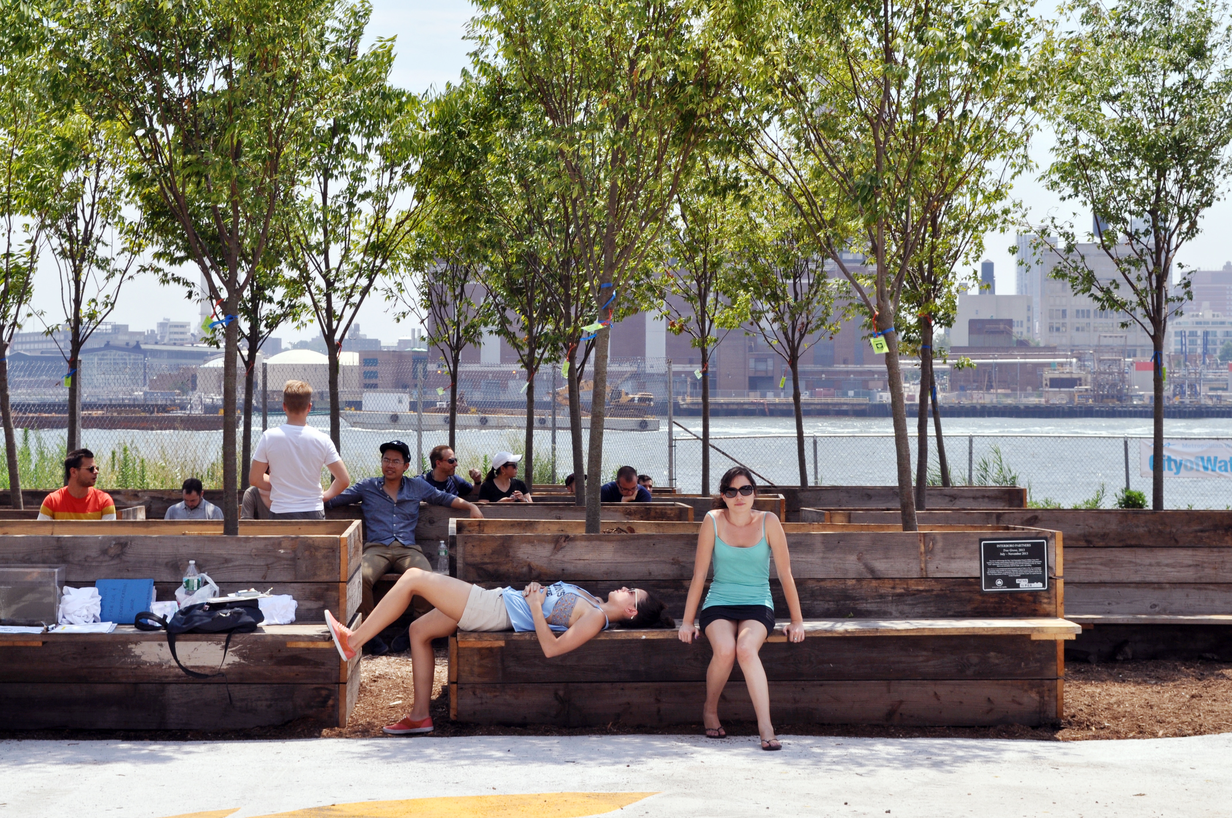
Today, only a small corner of Bushwick Inlet Park has been built, and it has become a cautionary tale for communities. The park design process takes years (in part because New York City’s Parks department does not have a capital budget and funds must be pieced together from the discretionary budgets of elected officials). In the interim, some groups have come up with unique ways to activate waterfront spaces that the city has promised as parks, this helps alert community members to the incoming green space and helps to hold land for community use. “When it comes to creating public spaces on the waterfront there is some concern that the upgrades promised to communities may never materialize,” said Dylan House the former Community Design Director at Hester Street Collaborative, a New York City urban planning, design and development nonprofit organization. House helped to spearhead the group’s Paths to Pier 42 initiative, which commissioned and installed temporary art and design installations on an abandoned pier in the Lower East Side. The pop-up space, is located on what was the last working cargo pier in the city (known as the “banana pier” because of the cargo brought ashore there by the Dole Fruit Co, it was closed in 1987). It will eventually become a city park, but Paths to Pier has helped to provided waterfront access for local residents in the interim. “When the city commits to building a public park it’s important to set up a physical presence in that space. It plants a flag and it also allows the community to build ownership of that space and claim it as a community space,” notes House, this encourages involvement in the long-term renovation project and keeps the focus on the lived experience of locals who use the site. As part of the initiative, Hester Street created infographics that diagram the park’s funding process and a model of the site hitched to a bike trailer that was peddled to various events and community meetings. This tactical approach provided community members with a rarely-seen opportunity to give design input and inroads to the public space decision-making process.
In the few remaining industrial areas of New York’s waterfront artists and activists have begun to work together to make sure that creative projects at the water’s edge do not jumpstart the engines of gentrification. In Brooklyn’s Greenpoint, a nature walk snakes along Newtown Creek, a body of water abutted by scrap yards, a sewage treatment plant, and freight depots. The inlit is famously polluted, hundreds of thousands of gallons of gasoline, fuel oil, and chemicals bubbled up from underground storage tanks unchecked for decades. A Superfund site since 2009, the zone is still in the very first phases of clean up. The Nature Walk is the brainchild of environmental artist George Trakas in cooperation with the city’s Department of Environmental Protection and the Department of Cultural Affairs. A plaque on site notes that it “does not divide the industry and the nature between which it is situated, but instead actively integrates the space… drawing the visitor into a dynamic narrative.” The installation—which makes use of benches, plantings, and stepped terraces—acknowledges the gravity of contamination while still creating space for recreation and contemplation. In this peculiar corner of the city art, leisure, and labor can live side by side.
As former shipping capitals swing towards knowledge-based economies their industrial bones are reworked. This shift has contributed to a new understanding of the harbor front, and it has presented opportunities for artists to orient the development of these formerly industrial neighborhoods. There is hope that artists can create works that look back at the communities from which they arise and point to avenues for growth. These artistic interventions—if developed with mechanisms that feed back into decision-making processes and a sensitivity to the on-the-ground situation—can provide a new way to solicit citizen participation. There are certainly snags to negotiate, but budding initiatives in New York and Amsterdam point to ways in which artists, community groups, and responsive planners can work together, defining a renewed role for artists in civic life and producing more meaningful public participation in the built environment.
Sam Holleran is a writer, interdisciplinary artist, and designer. His writing and research on graphic culture, urbanism, and architecture has appeared in publications like Urban Omnibus, PRINT, Public Books, and The Avery Review. He has worked with numerous nonprofits, community-based organizations, and educational institutions to create participatory planning projects, community design programs, and public art installations in and around city parks. Formerly a researcher at the Chair of Architecture and Urban Design at ETH-Zürich, he is currently the Urban & Social Design Lead at Ellery Studio, Berlin.